Sketch Map
|
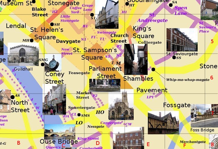
High Ousegate(HO) D7 Runs south south west from Pavement to Low Ousegate. Passes to the north of All Saints church, Pavement (pictured). Photo: taken 2005-7 |
Sketch Map
|
High Ousegate(HO) D7 Runs south south west from Pavement to Low Ousegate. Passes to the north of All Saints church, Pavement (pictured). Photo: taken 2005-7 |