Sketch Map
|
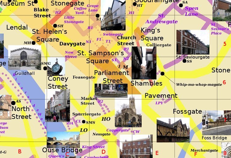
PavementE6 Runs south west from Stonebow to Parliament Street. Contains the 17th century Herbert House. The church of All Saints, Pavement (pictured) was originally at the south west end of Pavement but has been isolated from it by the building of Parliament Street (19th century) and Piccadilly (20th century) Photo: taken 2005-7 |