Sketch Map
|
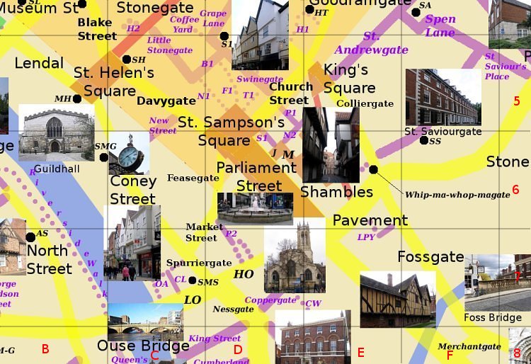
St. SaviourgateE6-F5 Runs north east from Whip-Ma-Whop-Magate (Pavement) to Spen Lane (near Peasholme Green). An 18th century street (pictured). Photo: taken 2005-7 |
Sketch Map
|
St. SaviourgateE6-F5 Runs north east from Whip-Ma-Whop-Magate (Pavement) to Spen Lane (near Peasholme Green). An 18th century street (pictured). Photo: taken 2005-7 |