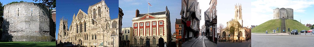
Eboracum
The Roman Foundation (71 - ~420).
After the creation of a fort on the site by the
Romans as a base for conquering the north of the island in 71 York quickly gained in
importance to become the major town in the Roman 'Britannia Inferior' (Lower Britain).
As the home of first the IX Legion and then the VI Legion, the area outside the fort
became a favorable site for settling of retired legionnaires, becoming a Colonia, probably
about 200. The layout of the Roman fort has resulted in the general layout of the
streets of York, with Stonegate being the Roman fort's via Praetoria, Petergate
(High and Low) being the Roman fort's via Principalis and Chapter House Street being
the Roman fort's via Decumana.
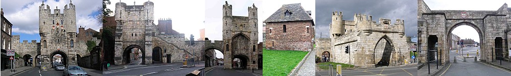
The north-west and north-east sections of the wall are built on top of the Roman
fort walls, and the walls south of the River Ouse are likely built following the line
of the Roman walls round the Colonia, at least in part.
|
Eoforwic
The Anglians (? - 840).
Jorvik
The Vikings. (840 - 960)
After the Roman Legion left in the early 5th century, a gap of 200 years occurs when
little is known of the happenings in York. By the 7th century York is appearing as an
ecclesiastical town which by the 9th century had become the capital of the British kingdom of
Northumbria (meaning north of the Humber). Such was the importance of this northern capital
that it became the focus of the Viking raids of the 9th century and by 860 Jorvik had become
the capital of the Viking Kingdom of Northumbria.
Most of the streets in the center of York appear to have been established as the Roman
fort disintegrated with the result that many of them are named using the Scandinavian name
for a street 'gata' translated into -gate (e.g. Fossgate, Goodramgate, Micklegate).
Two ancient streets do have the Anglian ending of 'street' (Coney Street and North
Street). The paths created either parallel to the old Roman fort walls, (Jubbergate,
St. Andrewgate, Aldwark)or from gate to gate (Goodramgate), or gate to centre (Feasgate,
Finkle Street, Grape Lane) of the ruined fort eventually formed the streets which still exists.
|
York
The English. (960 on)>
The defeat of the Vikings in 960 returned Northumbria to the unified English kingdom in
which it has since remained. Immediately after the Norman Conquest, Viking insurgents took
control of the city for a while but were decisively beaten by William who then proceeded to
burn the City including the large, rich library built up over the previous 4 centuries.
York prospered in the religious fervour of the 11th to 16th centuries, but this ended with
Henry VIII's reformation when the city's prosperity nose-dived, not to partially recover
until the 18th century, though this didn't last long. In the 19th and 20th centuries the
Railway and Confectionery industries brought some prosperity back to the city, though both
diminished in the last half of the 20th century. The lack of an
industrial base in the city before the mid-19th century meant that little rebuilding of the
medieval town occurred until then, and even then was not rapid, leading to many old buildings
remaining in the centre streets, though perhaps much altered as fashions changed.
For most of this time, the street pattern remained unchanged. In 1825 a major expansion
to the market was made by the creation of Parliament Street. In the late 19th century, slum
clearance allowed the creation of Clifford Street, to be followed in the early 20th Century
by the extension of Piccadilly into Pavement.
|