York Within the Walls: Micklegate


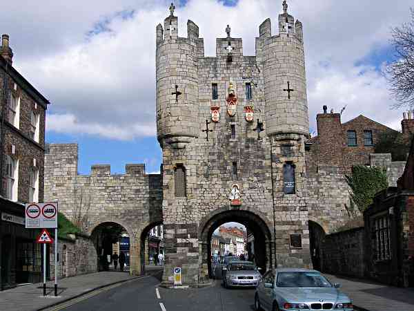
Looking towards Micklegate Micklegate Bar.

Interesting

Other Views

Directions

Name Derivation
Micklegate Bar I
Micklegate Bar II
Heads up

Statues
Arms
Arms II
Portcullis
1644 surrender
Sketch Map

Bear Left
Bear Right
Move Forward
Turn Left
Turn Back
Wall Walk

Micklegate.

After the old Roman crossing was washed away in floods a new river crossing was sited a few hundred metres down stream at the current site of Ouse Bridge. Micklegate was formed as a path from the old Roman gate through the walls surrounding the Colonia (civil town of Roman York) running at first parallel to the Roman main road (approximately on the line of Toft Green) and then curving down the hill to the new bridge site. As this was the only road and bridge over the Ouse into the city it was soon built up on each side and receiving its name of the Great Street

Photo: taken 16 April 2006. Photo Copyright Dave Woodcock 2008.

Home Page     Street Index     Place Index     Walk Index     References
This page last modified Wednesday, 14 January 2009.     Site owner: Dave Woodcock, who is solely responsible for the site contents.